


Stage Triacastela-Sarria por Samos
The French Way
- O Cebreiro
- Liñares
- Hospital da Condesa
- Padornelo
- Fonfría
- Biduedo
- Triacastela
- San Xil
- Aguiada
- Sarria
- Barbadelo
- Ferreiros
- Portomarín
- Gonzar
- Vendas de Narón
- A Eirexe
- Lestedo
- Palas de Rei
- San Xiao do Camiño
- O Leboreiro
- Melide
- Boente
- Ribadiso
- Arzúa
- A Salceda
- Santa Irene
- Arca, O Pino
- A Lavacolla
- Monte do Gozo
- Santiago
- O Cebreiro
- Liñares
- Hospital da Condesa
- Padornelo
- Fonfría
- Biduedo
- Triacastela
- San Cristovo do Real
- Samos
- Pascais
- Aguiada
- Sarria
- Barbadelo
- Ferreiros
- Portomarín
- Gonzar
- Vendas de Narón
- A Eirexe
- Lestedo
- Palas de Rei
- San Xiao do Camiño
- O Leboreiro
- Melide
- Boente
- Ribadiso
- Arzúa
- A Salceda
- Santa Irene
- Arca, O Pino
- A Lavacolla
- Monte do Gozo
- Santiago
Stage: Triacastela - Sarria (through Samos)
From Triacastela, passing through San Xil, the Way goes in the direction of Sarria through a chain of small towns in the Jacobean tradition such as A Balsa, Montán, Pintín, Calvor and San Mamede do Camiño.
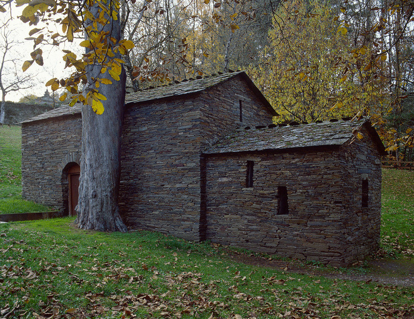
The variant of Samos turns south through the area of the River Sarria, which has beautiful landscapes and numerous examples of popular Galician architecture. It then goes in the direction of the Monastery of Samos, one of the oldest monasteries in the western world (VI century).
Triacastela- San Cristovo do Real
Leaving the municipality and the monument to the pilgrim on the left, we go down to the road crossing a little bridge over the River Sarria.
We then continue by the main highway, passing a snack bar and a recreational area on the banks of the river, until we reach San Cristovo do Real where, just at the entrance to the town, it is necessary to take a diversion signposted to the right. This goes down to the lower art of the town beside the river.
Triacastela - San Cristovo do Real
San Cristovo do Real- Samos
Leaving the Church of San Cristovo on the left, the Way crosses the River Sarria by two little bridges, one with a washing place. We then move on leaving the cemetery on the left taking the route to the right which runs between leafy chestnut trees.
Once we have passed Renche, Lastres and Freituxe (where there is a snack bar), we reach San Martiño do Real and, after a number of steep downhill stretches, Samos, where, besides the spectacular monastery, there are all the services a pilgrim might require.
San Cristovo do Real - Samos
Samos- Pascais
After a visit to the monastery and the capilla del Ciprés, we leave Samos by the road to Sarria, with the river on the left. The walk continues along the road to Teiguín, where we take the right bank of the river to the entrance to Pascais.
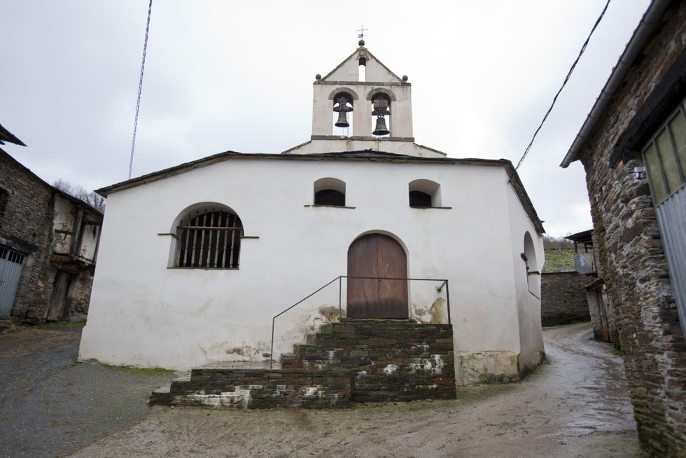
In Pascais, going down to the left by a stone path crossed by a stream, we find the Church of Santalla of Pascais and its rectory.
Samos - Pascais
Pascais- Aguiada
We then continue in the direction of Gorolfe, where we cross the bridge and then follow the directions to Reiriz.
On the way to Sivil, the river must remain on the left as we travel along quite flat terrain. We then go towards Aguiada, at approximately 4 km from Sarria.