


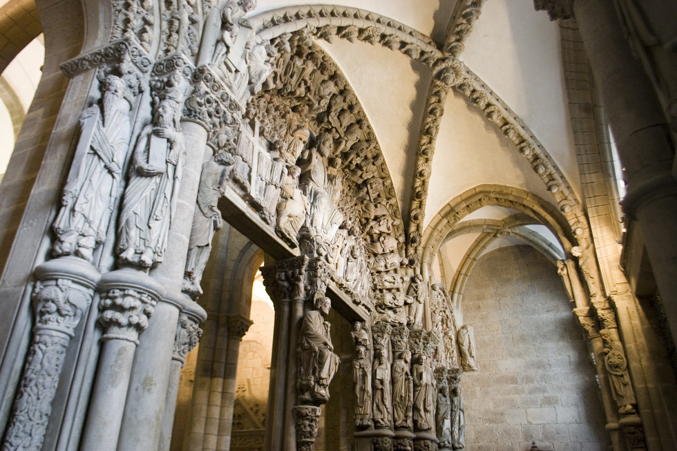
Portico of Glory, Santiago Cathedral
A walking tour by the Jacoben Santiago
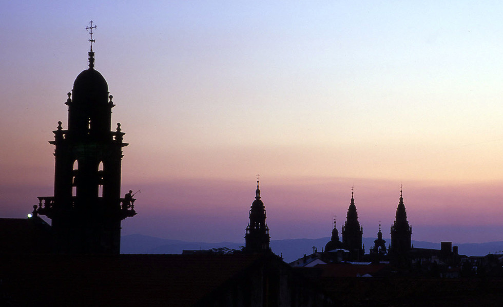
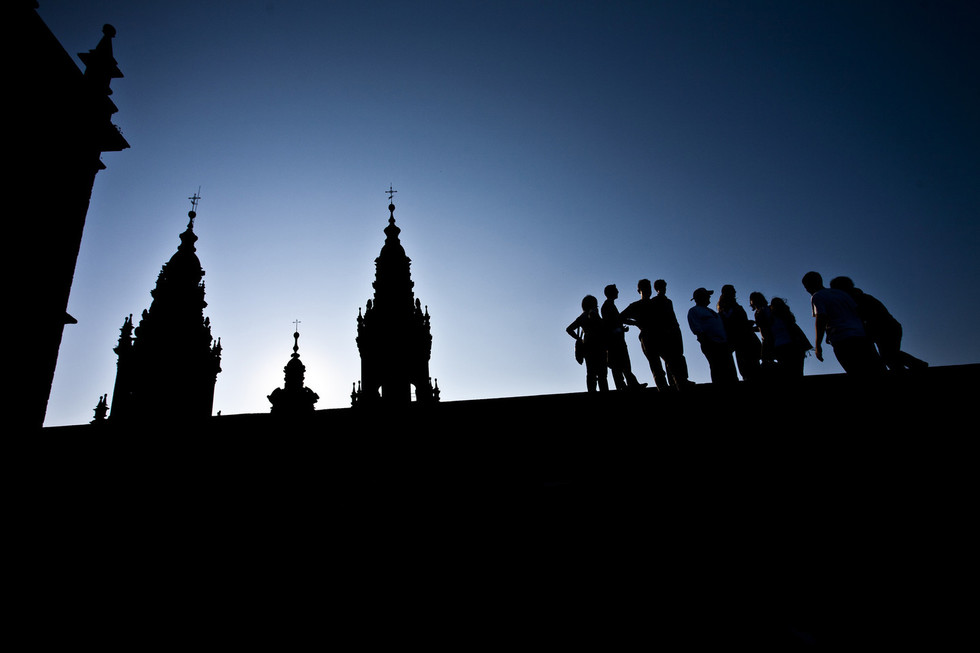
Cathedral and Praza do Obradoiro
The city of Santiago was founded and has grown up around the Apostle’s tomb. The pattern of its streets and squares, its place names and main historic buildings – emerging from the epicentre designated by the cathedral – are all evidence of this. Everything refers to the Way of St. James. The energy of this pilgrimage can be felt in every historic spot.
This short walking tour visits some of the most important locations in Compostela associated with the Way of St. James. We begin with the cathedral and the squares (prazas) around it, then expand our circle to take in the surrounding neighbourhoods.
Santiago Cathedral, consecrated in 1211, is one of the finest examples of European Romanesque art. It was built to receive the pilgrims who came from all over the continent to worship the remains of St. James the Apostle, which are held inside. The Pórtico da Gloria (Portico of Glory) is one of the world’s greatest artistic treasures. This incomparable structure carved out of granite is the work of Master Mateo, depicting his vision of the Apocalypse.
Art, history and spirituality make their presence felt in every corner of the temple. The best-known sections have now been joined by the recently excavated underground areas (including a Roman necropolis) and the opportunity to visit the roof.
Beside the great basilica stands Pazo de Xelmírez. This mansion is the best preserved example of civil architecture from medieval Spain. It was home to the first Archbishop of Santiago, Diego Xelmírez (12th century). The imposing Salón de Ceremonias (great hall) is especially noteworthy.
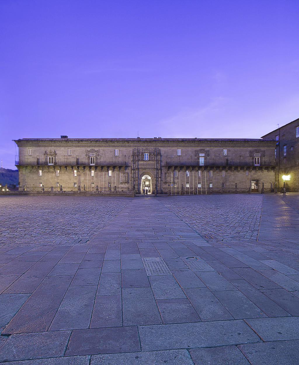
To the north of Praza do Obradoiro is the Royal Hospital, today the Parador Hostal dos Reis Católicos, part of the state-owned hotel chain. It was constructed in the 16th century to take in pilgrims.
Behind Pazo de Raxoi (another palace), to the left of San Fructuoso Church, there is now a charming boxwood maze surrounded by cypresses and gardens, offering magnificent views of Alameda Park. There is no trace of the city’s great pilgrim cemetery, which was located on this spot until the 18th century.
Squares and streets around the cathedral
We walk back around the cathedral and explore the streets (rúas) and squares (prazas) that have grown up in its shadow.

Continuing in the opposite direction, we come to Praza da Inmaculada, with San Martiño Pinario Monastery located on one side. Until the 16th century, this site was occupied by Santiago Hospital, which is mentioned in the Codex Calixtinus (12th century). The hospital provided medical care for pilgrims.
Today, Rúa do Franco is home to the largest concentration of eating establishments in the city, with a lively atmosphere any time of year. The street owes its name to the foreigners, ‘Franks’, who began to settle here as early as the 11th century. Many of them came to the city as pilgrims.
In iconic Praza da Quintana, under the Torre do Reloxo (the clock tower, which is lit up during holy years), a few short metres from the Porta Santa (Holy Door), a curious nocturnal shadow traces the exact silhouette of a mysterious pilgrim on the stone. One might imagine it is the wandering soul of one of the devout...
Local place names are a permanent reflection of the traces left by this great phenomenon over the centuries. This is the case of the Porta do Camiño (Door of the Way), which marked the end of the French Route. Some street and square names recall ancient trades. There is Rúa da Acibechería, named for the black azabache (jet) long prized by pilgrims and still popular at shops and jeweller’s in the area. Rúa dos Concheiros refers to the Compostela guild that sold shells (conchas), both natural and man-made, and Praza de Praterías, (Silversmiths Square) was where the precious metal was worked.
Today, Rúa do Franco is home to the largest concentration of eating establishments in the city, with a lively atmosphere any time of year. The street owes its name to the foreigners, ‘Franks’, who began to settle here as early as the 9th century. Many of them came to the city as pilgrims.
Rúa da Raíña (Queen Street) is an extension of Rúa do Franco. Its name commemorates the visit of St. Elizabeth of Portugal, wife of King Denis, who made the pilgrimage to Santiago in the 14th century. At her behest, St. Elizabeth was originally buried in Coimbra with the symbols of pilgrimage.
There are two lovely Romanesque churches in this immediate area: Santa María Salomé is the only Spanish church dedicated to the mother of St. James the Greater and his brother St. John the Evangelist. San Fiz de Solovio is located next to the busy Mercado de Abastos (food market). This site was once home to the hermit Pelayo, who first saw the lights which led to the body of St. James.
+ Information
Resources
Historic neighbourhoods
Historic Santiago neighbourhoods such as Conxo, Sar, San Lázaro and San Pedro have strong ties to the pilgrimage.
In the neighbourhoods of the city’s outskirts, at least 15–20 minutes from the cathedral on foot, we find that the Jacobean pilgrimage has again left its mark. To the south is Santa María de Conxo Monastery, one of the entrances on the Portuguese Route, dating from the era of Archbishop Xelmírez. To the east is Santa María de Sar Collegiate Church, gateway of the Vía de la Plata. To the north is San Domingos de Bonaval Monastery, named in honour of the pilgrimage which, according to tradition, St. Dominic de Guzman made in the year 1219. And when the French Route enters the city, it first comes to the San Lázaro neighbourhood and then the prototypical San Pedro neighbourhood.
It doesn’t matter which path you choose, all of them emerged and grew up as a result of the drive and pull of the pilgrimage.