


GR 53 PANORÁMICO DE VIGO

In The Way of Saint James
Location
Pontevedra
Mos | Redondela | Vigo | Gondomar
Coordinates: 42º 14' 54.9" N - 8º 40' 34.4" W
Coordinates: 42º 10' 02.9" N - 8º 48' 17.8" W
Description
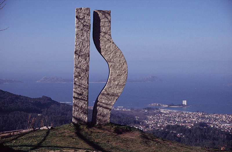
This itinerary skirts the municipal borders of Vigo across its mountainous side, giving remarkable views of the city and the ria.
It is a route designed to show people from this large city the natural environment that spreads out just a few metres from their homes. A series of forest parks have been located in parishes in Vigo District which, equipped with everything necessary for leisure and rest, are decisive in this pathways massive success at weekends.
There is also place for history, however: the Fragoselo petroglyphs, the dolmens in the area of El Mercantil and the remains of the old defensive wall of Monte O Galiñeiro.
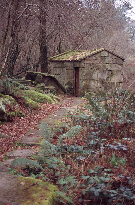
Rural architecture in Chandebrito and Fraga, the beautiful site of the As Maquías mill on the River Zamáns, autochthonous forests and this whole natural environment far removed from the hustle and bustle of the city, making this a highly attractive and much-visited pathway.
It is a route designed to show people from this large city the natural environment that spreads out just a few metres from their homes. A series of forest parks have been located in parishes in Vigo District which, equipped with everything necessary for leisure and rest, are decisive in this pathways massive success at weekends.
There is also place for history, however: the Fragoselo petroglyphs, the dolmens in the area of El Mercantil and the remains of the old defensive wall of Monte O Galiñeiro.
Rural architecture in Chandebrito and Fraga, the beautiful site of the As Maquías mill on the River Zamáns, autochthonous forests and this whole natural environment far removed from the hustle and bustle of the city, making this a highly attractive and much-visited pathway.
Longitude
The main pathway covers 39.9 km and the variations GR 53.1 and 53.2 cover a distance of 8.1 and 10.2 km respectively.
Point of Departure / Arrival
A Madroa (Vigo).
Saiáns (Vigo)
Route
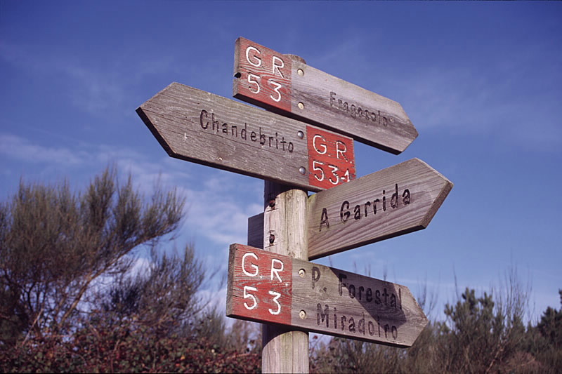
Saiáns, A Garrida, Puxeiros and A Madroa.
Difficulty
Medium
Duration
This is a very long route, so it is recommended to be tackled over several days. It has a large number of ups and downs although the
going is quite gentle.
going is quite gentle.
Equipment
If the plan is to do the whole pathway in a weekend, you will need enough equipment. Water is easy to find all along the route.
Services
Provisions in the towns surrounding Vigo.
M.I.D.E.
Effort M.I.D.E.:
Itinerary M.I.D.E.:
Displacement M.I.D.E.:
Enviroment M.I.D.E.:
Bicycle access
Partially suitable
Horse access
Totally suitable
cartography I.G.N. (1:25:000)
Cartography: Nº 223-II Redondela, 223-III Vigo, 223-IV Mos, 261-I Baiona, 261-II O Porriño.
Further information
Federación Galega de Montañismo
Tel.: 986 208 758 / Fax: 986 207 407
e-mail: sendeirismofgm@yahoo.es
www.fgmontanismo.com
Kind of route
Large travel
Interest
Scenic interest
Access
By town bus to Saiáns, A Garrida, University, Rebullón, Airport and A Madroa. In Saiáns, leave from the Church of San Xurxo. In A Madroa set off from in front of the zoo.
The Ways of St. James
Portiguese Route
Portiguese Route by coast
GR 53 PANORÁMICO DE VIGO
cargando mapa...
Download the coordinates of the tourist resource that we present ...
> Click here for help on downloading in different formats Initial pickup date: 01/08/2019