


PR-G 145 RUTA DA MARRONDA-ALTO EO

In The Way of Saint James
Location
Baleira - Lugo
Coordinates: 43º 04' 24.3" N - 7º 13' 39.5" W
Description
A circular walk divided into two sections that offers visitors the opportunity to discover the region of A Fonsagrada. Far from large towns and roads, the route boasts rich and unspoiled scenery in one of the least known areas of Galicia. A Marronda forest, of great ecological and hunting value, and the source of the river Eo are the protagonists of the route.
From San Paio, we would recommend doing the first stretch to the recreational area of Cortevella by going up eastwards by Pena Cerrada and then northwards to the Pena da Raia, until we come to A Marronda - a magnificent example of native Galician forest. Included in the “Nature 2000 Network” and a Biosphere Reserve, it is one of the main reserves of beech trees in the southwest of Europe.
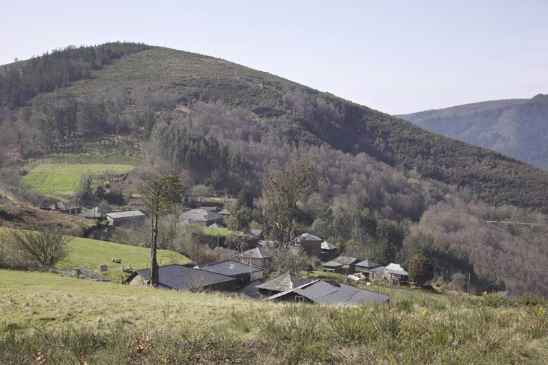
PR-G 145 Ruta da Marronda - Alto Eo After passing through the village of Mendreiras we begin a long descent back to the recreational area, where we can enjoy panoramic views from the viewpoint of O Ferreiro and visit the mill of the same name.
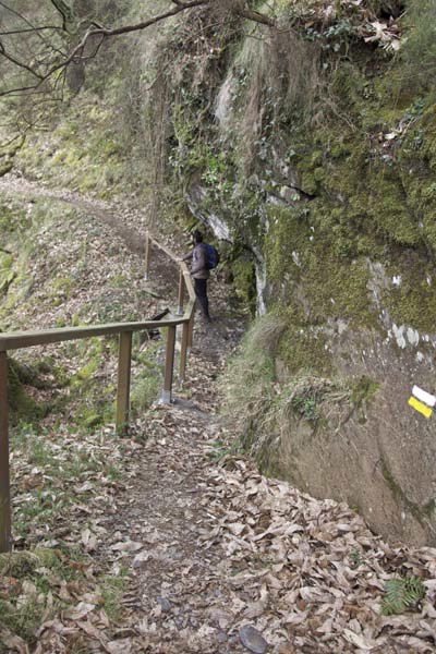
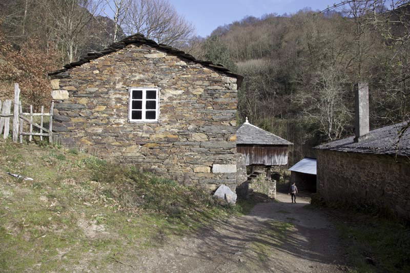
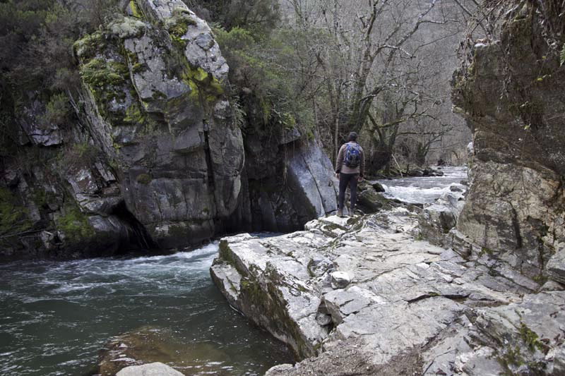
From here begins the second stretch of the route, along both banks of the River Eo to San Paio. In this section we cross the streams of A Teixeda and Monte Meán, and visit the waterfalls of O Pozo da Ferreira and Acea de Serra, as well as the small village of Cabreira.
In some sections we cross from one side of the river to the other, over bridges like Naseiro, where we finally leave the Eo behind and come back to San Paio.
From San Paio, we would recommend doing the first stretch to the recreational area of Cortevella by going up eastwards by Pena Cerrada and then northwards to the Pena da Raia, until we come to A Marronda - a magnificent example of native Galician forest. Included in the “Nature 2000 Network” and a Biosphere Reserve, it is one of the main reserves of beech trees in the southwest of Europe.
PR-G 145 Ruta da Marronda - Alto Eo After passing through the village of Mendreiras we begin a long descent back to the recreational area, where we can enjoy panoramic views from the viewpoint of O Ferreiro and visit the mill of the same name.
From here begins the second stretch of the route, along both banks of the River Eo to San Paio. In this section we cross the streams of A Teixeda and Monte Meán, and visit the waterfalls of O Pozo da Ferreira and Acea de Serra, as well as the small village of Cabreira.
In some sections we cross from one side of the river to the other, over bridges like Naseiro, where we finally leave the Eo behind and come back to San Paio.
Longitude
21,3 km.
Point of Departure / Arrival
San Paio (Baleira) - UTM:29T X:644415 Y:4770709
Route
San Paio, Pena da Raia, Mendreiras, A Cortevella, Cabreira, San Paio.
Difficulty
Medium - High
Duration
7 hours.
Services
Off the route, in O Cádavo.
M.I.D.E.
Effort M.I.D.E.:
Itinerary M.I.D.E.:
Displacement M.I.D.E.:
Enviroment M.I.D.E.:
Bicycle access
Totally suitable
Horse access
Totally suitable
cartography I.G.N. (1:25:000)
Cartography: 73-II Mosteiro y 73-IV Castroverde.
Further information
Concello de Baleira
Tel.: 982 354 059
info@concellodebaleira.es
concellodebaleira.es
Federación Galega de Montañismo
Tel.: 986 208 758 / Fax: 986 207 407
sendeirismofgm@yahoo.es
www.fgmontanismo.com
Segatur (Sendeiros de Galicia para o Turismo Rural S.L.)
Tel. 654 165 730 / 886 117 011
info@segatur.com
www.segatur.com
Kind of route
Small travel
Interest
General interest
Access
On the A-6 at the city of Lugo, take exit 493 onto the LU-530 towards A Fonsagrada. In O Cádavo turn off onto the LU-760 to Fonteo and after this village take the LU-P-0405 to San Paio.
The Ways of St. James
The Primitive Camino
PR-G 145 RUTA DA MARRONDA-ALTO EO
cargando mapa...
Download the coordinates of the tourist resource that we present ...
> Click here for help on downloading in different formats Initial pickup date: 01/08/2019