


PR-G 107 SENDEIRO DE PEDRA MIRANDA

In The Way of Saint James
Location
Pontevedra
Soutomaior | Vilaboa
Coordinates: 42º 21' 45.5" N - 8º 37' 28.8" W
Coordinates: 42º 21' 05.5" N - 8º 37' 13.5" W
Description
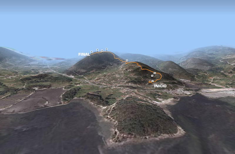
At the start of this route we come across a lagoon in the former quarry of A Lapa. From here head upwards past the old quarry and after passing a water tank, we follow a path bordered by tall pine trees, and come to Alto da Lapa.
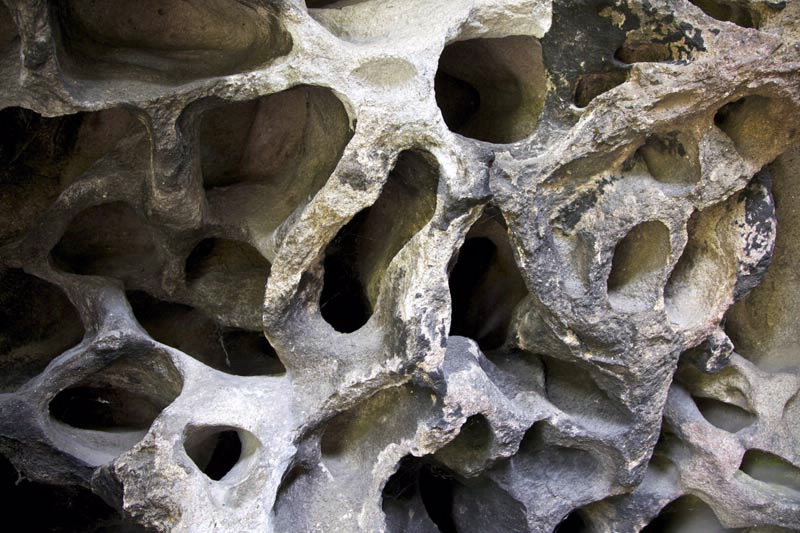
We continue to go upwards, leaving behind the chapel of San Amaro in Cacheiro, reaching the highest point of the route, which is easily identifiable by the rock formation shaped like a cave, known as Pedra Miranda.
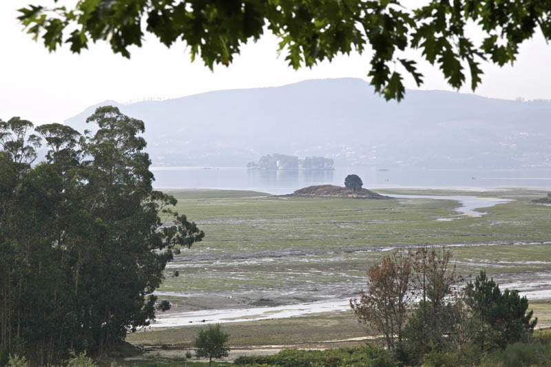
At the end of the route is a natural viewpoint from where you can admire the bays of San Simón and Rande.
Longitude
2,45 km. (The main route is 2.3 km and the diversion 150m).
Point of Departure / Arrival
End of the Paredes road 300m from Pedra Miranda - UTM:29T X:531031 Y:4690327
Car park before the quarry of A Lapa - UTM:29T X:531386 Y:4689092
Route
A Lapa quarry, Alto da Lapa, Chapel of San Amaro, Pedro Miranda.
Difficulty
Low
Duration
0,5 hours.
Services
In Cacheiro
M.I.D.E.
Effort M.I.D.E.:
Itinerary M.I.D.E.:
Displacement M.I.D.E.:
Enviroment M.I.D.E.:
Bicycle access
Totally suitable
Horse access
Totally suitable
cartography I.G.N. (1:25:000)
Cartography: 185-IV Soutomaior
Further information
Concello de Vilaboa
Tel.: 986 708 215 - 986 708 252
info@vilaboa.org
www.vilaboa.org
Tel.: 986 708 215 - 986 708 252
info@vilaboa.org
www.vilaboa.org
Kind of route
Small travel
Interest
Scenic interest
Access
On the N-550 from Pontevedra to Arcade, at kilometer 132 there is a sign indicating the route.
The Ways of St. James
Portiguese Route
Portiguese Route by coast
PR-G 107 SENDEIRO DE PEDRA MIRANDA
cargando mapa...
Download the coordinates of the tourist resource that we present ...
> Click here for help on downloading in different formats Initial pickup date: 01/08/2019